Wildfires are no longer a seasonal, local news story. The summer of 2026 has seen record-breaking heatwaves and droughts across Europe, resulting in wildfires of an unprecedented scale and severity. As the climate conditions intensify and fire-related losses mount, policymakers, corporate stakeholders, and the general public alike are seeking to understand their exposure to wildfire risk to support better decision-making.
Answering this question is more difficult than it sounds. Wildfires are fast-moving, geographically uneven, and driven by the ever-changing dynamic between vegetation, weather, and human activity. The conditions that determine whether a fire starts, how quickly it spreads, and how severely it affects people and assets can vary significantly over relatively small distances. As a result, wildfire risk does not map neatly onto conventional models primarily based on historical losses or broad regional classifications.
Moving from "this region is fire-prone" to "this specific asset faces this specific degree of exposure" requires a much more granular approach. It means combining high-resolution satellite and Earth observation data with detailed information on vegetation and weather conditions, precise asset geolocation, and physical damage functions calibrated to how fire behaves on the ground. Crucially, it also means looking beyond where fires have occurred in the past to understand how changing climate conditions may alter the location, frequency, and severity of future events.
Fortunately, rapid advancements in climate science, Earth observation, and physical modelling are improving wildfire detection and monitoring every day. The EDHEC Climate Institute and Climate Innov are at the forefront of these developments, translating advances in physical climate science into tools that can help to quantify the financial implications of wildfire risk.
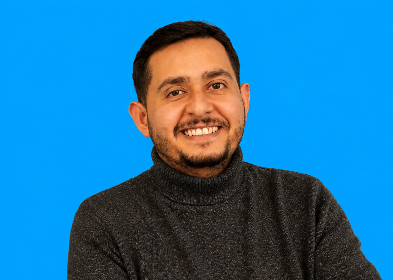
This Q&A with Ahmed El Fadhel, CTO & Co-Founder of Climate Innov, explores precisely how we quantify wildfire risk, from the data sources underpinning wildfire hazard projections to the models used to assess the probability and potential severity of fire events.
In the partnership between the EDHEC Climate Institute and Climate Innov, what does each party bring?
It’s a meeting of two complementary missions. The EDHEC Climate Institute (ECI) is one of Europe’s leading research centres on climate risk. Its mission is to make sure research reaches decision-makers. In this operation, ECI brings its scientific credibility, its national and international reach, and, crucially, full funding, so that the SecuFire Action ecosystem can be offered free of charge, on request, to all of France’s public wildfire actors: firefighting services, and the authorities responsible for prevention.
Climate Innov brings technology and operational science: we are a research and engineering company specialising in extreme natural risks accelerated and intensified by climate change, and SecuFire Action is the result of several years of R&D and field validation. Concretely, that means four modules the services can adopt progressively: very-high-precision weather (through our partnership with Spire Global, the world’s largest commercial constellation of radio-occultation nanosatellites), 3-D topography, satellite vegetation mapping (density, height, water stress, etc.) and physical fire-spread simulation built on the Balbi model developed with CNRS and the Università di Corsica.
The ECI turns research into a public commitment, while we turn satellite data into decisions. Neither of us replaces the expertise of fire crews: we give commanders the most reliable information possible, when it matters. Our shared ambition is measurable: reducing burned areas by up to 30%.
Beyond detecting fires, how have satellite data shaped modern wildfire science?
Detection is only the visible tip. The deeper revolution is that satellites turned wildfire science from a local discipline into a global, quantitative one.
First, we finally know what actually burns: more than twenty years of systematic burned-area mapping gave us a world atlas of fire (where fires start, how big they grow, how regimes are shifting with climate change). No ground network could ever have produced that. Second, satellites measure the state of the fuel before any smoke appears: vegetation density, canopy height, and above all water stress (how dry and flammable the landscape is, day by day). Third, thermal sensors measure fire intensity and emissions while a fire burns (how much energy it releases, how much CO₂ and fine-particle pollution it sends up). And finally, after the fire, we map severity and recovery, which feeds back into understanding how ecosystems and risk evolve.
The result is that every serious fire model today (statistical or physical) is trained, fed or validated with satellite data. When I say climate change is making fire seasons longer and moving risk into regions with no fire culture, that’s not an impression; it’s measured from orbit.
What are the different types of satellites involved, and what does each provide?
Think of it as a layered system: each orbit and each sensor answers a different question.
- Geostationary weather satellites (like Meteosat and MTG) stare at the same hemisphere and refresh every few minutes: that’s early detection and fire-weather monitoring in near real time.
- Polar-orbiting optical satellites do the fine mapping: Sentinel-2 or Landsat see vegetation and burn scars at 10–30 m; thermal sensors like VIIRS pick up active fire hotspots several times a day worldwide.
- Thermal infrared sensors (Sentinel-3, Landsat) measure land-surface temperature: a direct window on drought and vegetation water stress. We even downscale it: combining Sentinel-3’s 1 km thermal picture with Sentinel-2’s 20 m detail.
- Radar (SAR) satellites like Sentinel-1 see through cloud and smoke, day and night: invaluable for structure, soil moisture and burned-area mapping when optical satellites are blind.
- LiDAR from space, NASA’s GEDI, shoots laser pulses that profile the vertical structure of forests: canopy height, biomass, and therefore fuel load.
- Atmospheric satellites (Sentinel-5P) track smoke plumes and air quality, increasingly a public-health issue.
- Radio-occultation nanosatellites, like Spire’s constellation, profile the atmosphere by measuring how GPS signals bend through it, feeding sharper weather forecasts, the single most decisive input on a fire day.
No single satellite tells you the risk. The craft is in fusing them.
How and why does wildfire modelling in France differ from Canada, Australia, or the western USA?
The big historical systems are empirical: they were fitted to decades of observed fires. Canada’s national system was built on the boreal forest; Australia’s on eucalypt landscapes; the American Rothermel model on laboratory burns, later scaled to the conifer West. They work remarkably well where they were calibrated, vast, relatively homogeneous fuel beds with a long record of very large fires to learn from.
France is the opposite case, for three reasons. First, the landscape: the Mediterranean is a fragmented mosaic (garrigue, maquis, oak, pine, vineyards, villages) with steep terrain and violent local winds. Fuel changes every few hundred meters, so region-wide statistical averages break down. Second, the fire regime: French doctrine is massive, rapid initial attack, so most fires are stopped small (which is a success, but it means we have far less “large fire” data to fit an empirical model to). Third, and this is decisive today: climate change keeps invalidating history. 2022 put major fires in Brittany and the Landes; risk is moving north into areas with no fire record at all. A model that only learns from the past struggles with a future that doesn’t resemble it.
That’s why the French school, notably the Balbi model from the Università di Corsica and CNRS, which we use in SecuFire Action, is physics-based: it computes fire spread from the actual mechanisms (radiation, convection, wind, slope, and fuel moisture). Physics doesn’t need a century of local fire history; it needs good input data. And that input data is exactly what satellites now provide.
How do you integrate satellite observations with meteorology, vegetation, topography, and physical propagation models?
It’s a pipeline: each layer feeds the next.
Vegetation: optical, radar and LiDAR data are fused into fuel maps: what type of vegetation, how dense, how tall, and how dry, updated continuously from thermal and moisture signals.
Topography: satellite-derived elevation models give slope and terrain configuration, which drive fire behaviour as much as wind does.
Weather: radio-occultation profiles and ground observations improve the forecast models, which we downscale to the fire zone, because the wind that matters is the one in that valley, not the regional average.
All three become the inputs of the physical propagation model. The Balbi model computes the rate of spread from the energy balance of the flame front: fuel load and moisture, wind, slope. Feed it good satellite-derived inputs and it draws the probable contours of the fire in the coming hours.
Then comes the step people underestimate: assimilation. A simulation is never fired once and forgotten. Each new satellite or aerial detection, each new observation of the real fire front, re-anchors the simulation to reality, and the projection is recomputed. It’s the same philosophy as modern weather forecasting: model plus continuous correction by observation.
The commander sees none of that machinery. What they see is a map: where the fire is likely to be in one hour, in three hours, and which assets are in its path.
What role does AI play in processing and assimilating these large datasets?
AI is the factory that makes the science usable at scale. Every day, the satellites I mentioned produce terabytes over Europe alone: no human team can process that. So AI does the heavy lifting: classifying and segmenting imagery into vegetation types, fusing optical, radar, LiDAR and thermal sources, downscaling (like sharpening a 1 km thermal image to 20 m using its correlation with fine optical detail) and filling gaps when clouds hide the ground.
Second role: learning risk patterns. We train models on the global fire archive (weather, vegetation, topography, human presence) to estimate ignition probability. That’s how you get a fire-risk map for anywhere on Earth, updated as conditions change, including under future climate scenarios.
Third, and to me most interesting: AI and physics working together. Physical models are explainable and extrapolate to conditions never seen before (essential in a changing climate). AI is fast and handles complexity. We use AI to prepare the physics’ inputs, to calibrate it, and to accelerate it so a spread simulation is available in minutes, not hours.
I insist on one point: we don’t use AI as a black box that “predicts fire”. In safety-critical decisions, an operational commander must be able to trust and interrogate the tool. The physics guarantees the why; AI provides the scale and speed.
How do these capabilities support prevention, operational response, and adaptation?
Same data, three time horizons.
Prevention - before the fire. High-resolution risk maps tell authorities where the danger concentrates, so fuel management, patrols and public warnings go where they matter. For this purpose, we developed and publicly shared the website ensemblepourlaforet.fr, which includes a risk map for all French territory displaying the hour-by-hour wildfire ignition risk, updated twice a day. With modern satellite-fed forecasting, we can flag fire outbreak conditions at a granularity of a few kilometres.
Response - during the fire. Real-time detection, then physical simulation of the spread, refreshed as observations come in, with automatic alerts on what stands in the fire’s path: homes, infrastructure, sensitive sites. The ambition we’ve set with the EDHEC Climate Institute is concrete: help reduce burned areas by up to 30%, which also means 10–30% less CO₂ and fine-particle emissions. Every minute gained and every better-informed decision makes the difference.
Adaptation - after, and for the decades ahead. The same models run under IPCC climate scenarios, project risk to 2050 and beyond. That’s what regions need for land-use planning, what utilities need to harden their networks, and what investors and insurers need to understand what climate change does to their assets. Fire is no longer only a summer emergency. It’s a structural risk to price, plan for, and reduce.
Our job is to make sure that at every one of those horizons, decision-makers are not flying blind.
Going further
Wildfire risk is becoming a growing challenge for public authorities, businesses and investors alike. Explore how the EDHEC Climate Institute and Climate Innov are combining climate science, satellite data and physical modelling to better anticipate, assess and manage this evolving risk.
→ Explore SecuFire Action
→ Learn more about the ECI and Climate Innov wildfire initiatives